


|
Chiricahua Mountain Sky Island Dream Property for Sale: The Morrow Ranch |

|
.jpg)
Click the picture above for information
on ordering
The Chiricahua Journals.
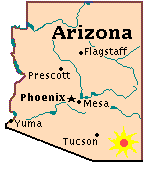
For more than one hundred years, the Morrow family has lived in the historic and picturesque Chiricahua Mountains in southeastern Arizona’s Cochise County.
The Chiricahuas, one of the “sky island” ranges rising out of southern Arizona’s Sonoran desert, soar to an altitude of nearly 10,000 feet. These mountains boast a dizzying array of plant and animal life — which is why the American Museum of Natural History long ago located its Southwestern Research Station here. In the 1800s, they were home to the legendary Apache chiefs Cochise and Geronimo, as well as the colorful mining boom towns of Galeyville and Paradise.
The Chiricahuas are secluded and private, yet easily accessible from Tucson, Phoenix, or El Paso via Interstate 10 and county-maintained roads.
Follow the links at the left to see photos and maps of this special corner of the southwestern United States.
This page created and maintained by
tiomiguel@hotmail.com.
Copyright reserved Michael W. Morrow. © 1997–2013
No text or images on this site may
be copied, reproduced, or redistributed without
the written permission of the author.